The vertical adjustment feature shifts surveyed data up or down by a user specified offset. This can be useful if data errors or datum shifts need to be applied to an entire set of survey data. This operation is performed on a single survey and adjusts all cross section surveyed points collected as part of this survey. It does not, however, alter any other surveys contained in the same database.
The vertical adjustment is defined by a series of inflection points. Each inflection point has river mile and vertical shift. the shift is positive for an upward adjustment and negative for downward. The software determines the relative adjustment at each cross section location by interpolating between these inflection points for the desired river mile. In the simplest case, two inflections points should be provided, one at the most upstream cross section with the survey and one for the downstream. Alternatively, precise elevation adjustments can be specified for each cross section location.
Adjusting vertical elevations is permanent and cannot be undone! It is strongly recommended that you make a backup of your cross section viewer database before performing this operation.
To perform a vertical adjustment for a single survey:
- Choose
Surveysfrom the mainDatamenu. - Click
Adjust Survey Data Vertical Elevations...from theEditmenu. - Select the survey that is to be adjusted.
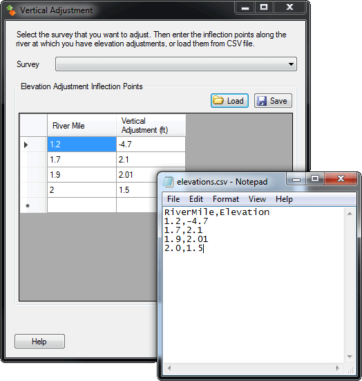
- Either enter the river miles and vertical adjustments by hand, or load them from a comma separated value (CSV) file. The CSV file should have two columns of data for river miles and elevations, separated by a comma; one cross section per row. A header row is required with the columns
RiverMileandElevation.
Clicking OK performs the vertical adjustment and shifts each surveyed point by the specified elevation, interpolating elevation shifts for cross sections that occur between the specified river miles.