The profile area of a cross section is performed throughout the Cross Section Viewer software by calculating the area of the polygon described by the surveyed points. This shape is always considered two-dimensional and does not account for any offset or longitudinal variation in the survey points. It simply uses station and elevation.
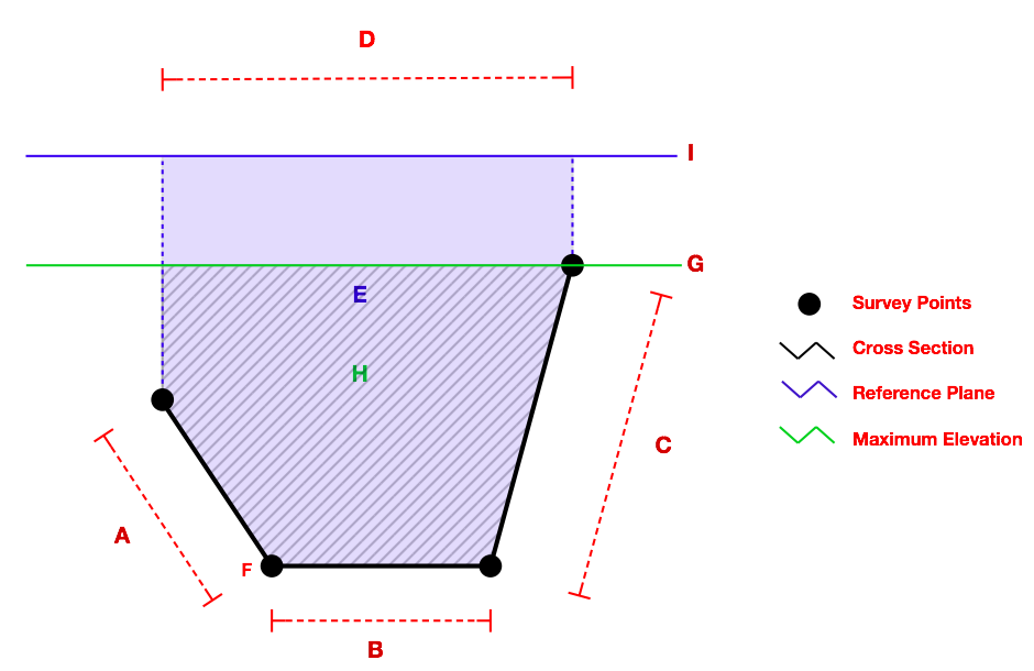
D = Straight Length
A + B + C = Bed Length
E = Construction Reference Profile
F = Minimumm Elevation
G = Maximum Elevation
I = Construction Reference Plane
G - ((H/D)2) = Average Elevation
H = Cross Section Area
The offset respresents the Euclidean distance of the point that was actually surveyed from the position on the monumented cross section that it represents. It can be illustrated as below:

Typically the surveyed ends of a cross section do not occur at the same elevation and so the software always levels the top of the cross section by either:
- Adding a temporary survey point at one or both ends of the survey the same elevation as the highest point along the cross section.
- Capping the cross section at the height of a reference stage, such as the CRP or some user-defined, vertical offset from this reference stage.