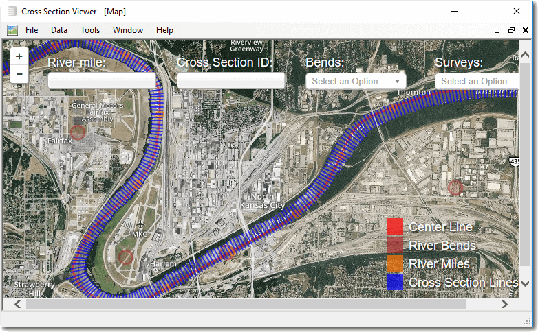
The map viewer is an interactive map showing the location of the cross sections stored in the database along with several other pieces of useful reference information. This feature only applies to the original Missouri River Database.
Note that while the cross sections, bends and river miles shown in the map are stored in the database and managed through the cross section viewer software, the map does not currently reflect these changes. The map is based on a static snapshot of the data in the database and does not update automatically. Contact the developers to discuss how to update the information shown in the map.
Displaying Features
The map viewer currently displays an aerial satellite map together with layers for the Missouri River centerline, river bend names, river miles and surveyed cross sections.
The layers are scale dependent. When zoomed out more than a certain level only the centerline is shown. Zooming in closer makes the centerline and bends visible. And finally, when zoomed in enough the cross section layers become visible. Layer visibility can also be controlled manually by clicking on the corresponding legend box in the bottom right of the map.
Finding Features
There are several ways to find cross sections, bends and river miles in the map. The most basic is simply to click on the map and drag the cursor in the direction that you want to pan. Double clicking the map zooms in on the location clicked. The Plus/Minus control in the top left of the map also controls the zoom level.
River Miles - Click on the text box in the top left of the map and type a river mile (whole integers only) and then press enter. The map will pan to the corresponding location.
Cross Section ID - Click on the cross section box and type in the integer ID of a cross section on the Missouri River (between 1 and 11,813) and then press enter. The map will pan to the corresponding location.
Bends - You can either click on the bend dropdown list and scroll to the desired name, or you can click and then start typing the name of the bend that you want. The list will start filtering to those bend names that match the text that you have started to type.
Surveys - You can highlight the cross sections contained in particular surveys by clicking on the dropdown and picking the desired survey. The map turns grey any cross sections that were not collected as part of the desired survey.
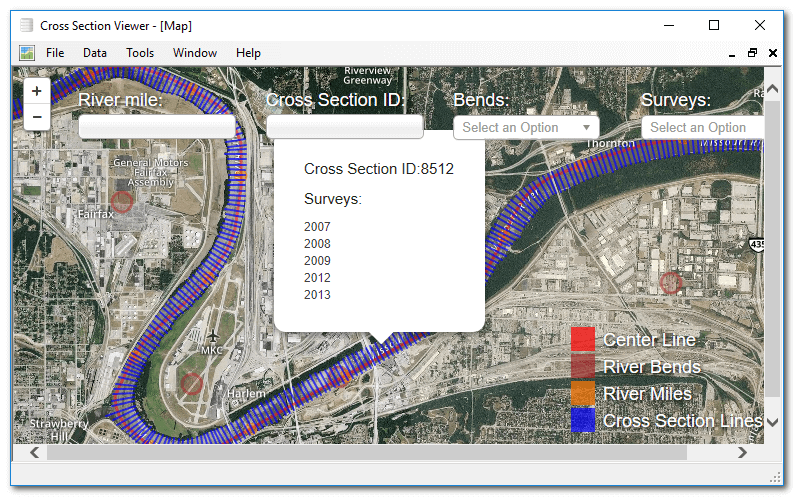
Identifying Features
Click on any layer feature to open a popup showing information about a particular feature. Clicking on a cross section will open a popup that lists all of the surveys in which data were collected for that particular cross section.
Base Map
The base map used is sourced from Mapbox, Licensed under Mapbox Terms of Service. Includes commercial imagery acquired and processed by DigitalGlobe; Geodatastyrelsen, FOT Orthophoto, 2014; LGV Hamburg; National Land Survey of Finland, NLS Orthophotos, 2014; Geoportal Berlin, DOP orthophotos, 2014; and other imagery derived from public sources and processed by Mapbox.