The navigation channel tool calculates the widest and deepest channels that satisfy user defined criteria. The tool operates on cross sections within a single survey. The ends of each cross section are extended vertically up to a reference plane, from which all depths are measured. Qualifying channels are then defined as rectangles extending vertically down from the reference plane to the specified depth and horizontally along the cross section to at least the specified width.
The tool identifies all continuous portions of each cross section that are deeper than the specified minimum depth and at least as wide as the minimum width. From this list of “qualifying channels”, the tool reports both the widest qualifying channel as well as the deepest qualifying channel that has the specified minimim width.
Any sections of the cross section that are shallower than the minimum depth are ignored entirely. Note that, depending on the minimum depth and width specified, that there may not be a solution for all cross sections (see the section on Generating Selections below for identifying which cross sections do or do not possess a solution).
Inputs
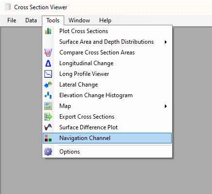
The navigation channel tool is available under the Tools menu, once a Cross Section Viewer database is open.
- Survey - a single survey of cross sections.
- Selection - a subset of cross sections on which the tool will operate. Cross sections that were collected in the selected survey, but are not part of the selection will be ignored.
- Reference Surface - the horizontal plane from which depths are reported.
- Station Filtering - The tool can operate on survey points along the entire length of each cross section, or it can be constrainted to just those points between or outside of reference station pairs.
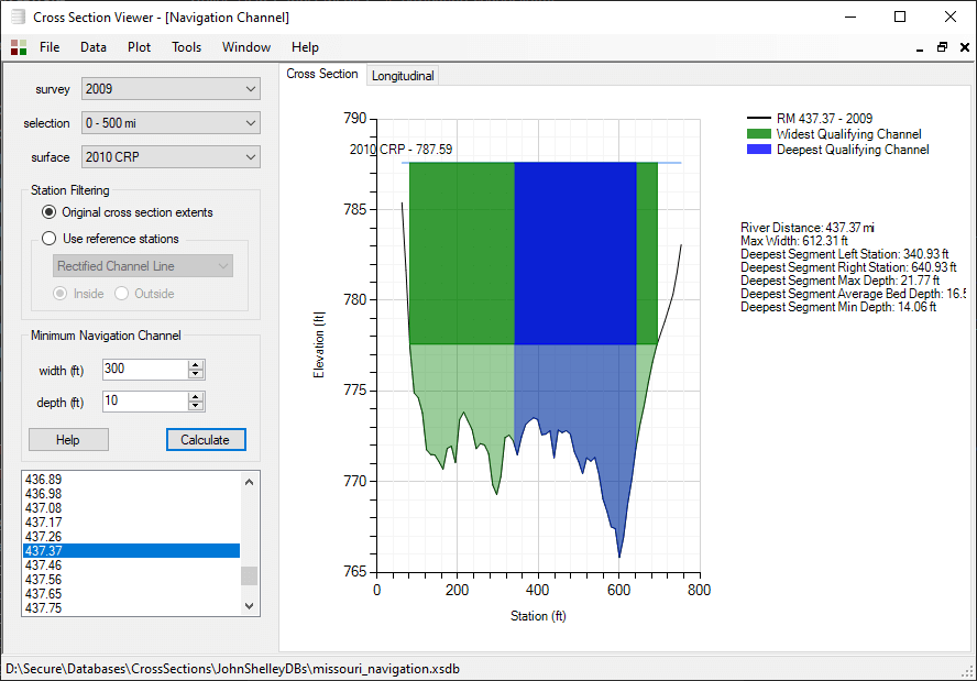
Click the calculate button to perform the navigation channel analysis. Then select an individual cross section to visualize the results. The widest qualifying channel is displayed in green and the deepest channel in blue. The minimum depth is shown in bold.
Export Results
You can export the results for all cross sections to a comma separated value (CSV) file. Each row in the CSV file represents an individual cross section where a soluton was obtained. Cross sections where there was no solution are omitted from the file. The CSV contains the following columns:
- River Distance - the distance down the channel of the cross section.
- Minimum Depth - the user specified minimum depth.
- Minimum Width - the user specified minimum width.
- Widest channel Width - the width of the widest qualifying segment, calculated as the right minus left station.
- Deepest Segment Left Station - the left of river station where the deepest qualifying segment starts.
- Deepest Segment Right Station - the right of river station where the deepest qualifying segment ends.
- Deepest Segment Average Bed - the average depth of the bed in the deepest qualifying segument.
- Deepest Segment Min Depth - the minimum depth of the deepest segment of specified width.
- Deepest Segment Max Depth - the maximum depth of the deepest segment.
Use the Plot menu to export the results of the analysis or to save the current cross section chart to an image file.
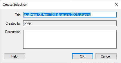
Generating Selections
Use the Plot menu to create new selections from either the list of cross sections for which a solution to the current analysis was found or not found. Provide a unique name for the selection as well as an optional description.